At the bottom of this map you can see where State HWY 541 intersects IH 37. If you move upward a short distance you can just detect County Road 427 as it leaves the Interstate. This is on the light blue or second choice plan. Lets all hope they go with the dark blue plan.
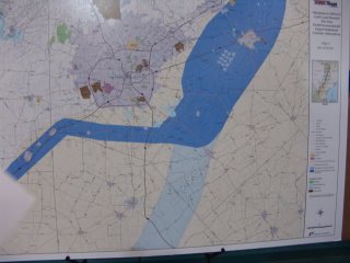
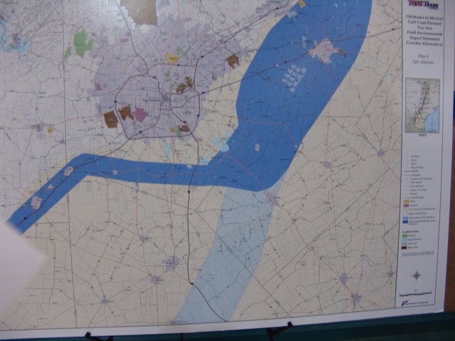
This is a map of the proposed highway and the alternate routes. Most of the blue shaded areas are ten miles wide. The actual route will be approximately one quarter mile wide...... that is 160 acres per mile of road. Think about that and it's effect on everyone in the path. Oh, and the state will own all of the gas stations, restaurants, and any other commercial interests along the way. I think the word is ..... upsetting!
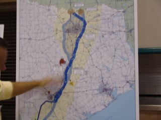
 At the bottom of this map you can see where State HWY 541 intersects IH 37. If you move upward a short distance you can just detect County Road 427 as it leaves the Interstate. This is on the light blue or second choice plan. Lets all hope they go with the dark blue plan.
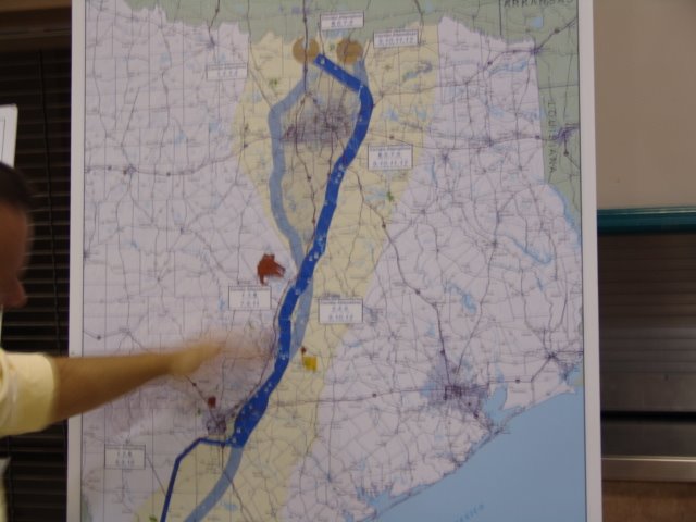 This is a map of the proposed highway and the alternate routes. Most of the blue shaded areas are ten miles wide. The actual route will be approximately one quarter mile wide...... that is 160 acres per mile of road. Think about that and it's effect on everyone in the path. Oh, and the state will own all of the gas stations, restaurants, and any other commercial interests along the way. I think the word is ..... upsetting!
No comments:
Post a Comment